02 / REGIONAL SITUATIONAL AWARENESS
OpenEMBER
See the wider picture around the outage.
A Long Island adaptation of OpenEMBER that brings regional maps, environmental observations, and advisory chat into one workspace.
External app · Access or sign-in requirements may apply.
APPLICATION WALKTHROUGH
Inside the application.
Fresh captures of the running app, with the visible interface and data preserved. Open any image to see it at full size.
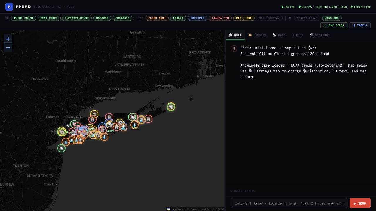
Regional map & advisory workspace
View full size ↗The React interface places configured regional layers and weather observations beside the advisory chat workspace. Radar and Rockaway service-request layers are hidden in this view to make the map easier to see.
Captured from the Vercel app · October 11, 2026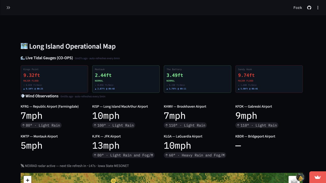
Water & wind observations
View full size ↗The Streamlit version presents tidal-gauge summaries and regional wind observations above the operational map. Values and status labels are preserved as the app displayed them at capture time.
Captured from the Streamlit app · October 11, 2026Screenshots are static snapshots, not live operational information.
The problem
Electric utility response happens within a wider emergency. Weather, tidal conditions, flooding, transportation, and regional hazards can all change the operating picture.
The approach
This OpenEMBER adaptation focuses on Nassau County, Suffolk County, and the Rockaway area. It combines configured knowledge resources with regional data sources and map layers, with React and Streamlit interfaces.
Regional mapping
Explore configured infrastructure and hazard layers.
Environmental context
View weather, water-level, and regional observations.
Source awareness
Keep freshness and availability visible.
Advisory chat
Explore questions with configured regional context.
Current scope
An evolving regional prototype. Source coverage, availability, and freshness vary; configured sources may be unavailable or access-restricted. This portfolio describes Tony’s regional adaptation of the upstream OpenEMBER project.
Project repository ↗ Repository access may be required.